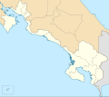
File:Costa Rica Puntarenas location map.svg
Appearance

Size of this PNG preview of this SVG file: 676 × 599 pixels. Other resolutions: 271 × 240 pixels | 541 × 480 pixels | 866 × 768 pixels | 1,155 × 1,024 pixels | 2,310 × 2,048 pixels | 732 × 649 pixels.
Original file (SVG file, nominally 732 × 649 pixels, file size: 2.19 MB)
File history
Click on a date/time to view the file as it appeared at that time.
| Date/Time | Thumbnail | Dimensions | User | Comment | |
|---|---|---|---|---|---|
| current | 23:11, 17 February 2014 |  | 732 × 649 (2.19 MB) | Milenioscuro | User created page with UploadWizard |
File usage
No pages on the English Wikipedia use this file (pages on other projects are not listed).
Global file usage
The following other wikis use this file:
- Usage on de.wikipedia.org
- Usage on es.wikipedia.org
- Miramar (Costa Rica)
- Chomes
- La Gamba
- Espíritu Santo (Costa Rica)
- Tivives
- Cantón de Puerto Jiménez
- Cóbano
- Parrita
- Ciudad Cortés (Costa Rica)
- Cedral (Costa Rica)
- Wikiproyecto:Ilustración/Taller de Cartografía/Realizaciones/América del Norte
- Quepos
- Palmar (Costa Rica)
- Buenos Aires (Costa Rica)
- San Isidro (Montes de Oro)
- La Unión (Montes de Oro)
- Cantón de Monteverde
- San Vito (Coto Brus)
- Bahía Drake
- Coto (Costa Rica)
- Plantilla:Mapa de localización de Provincia de Puntarenas
- Jacó
- Dominical (Costa Rica)
- Sierpe (Costa Rica)
- Bahía Ballena (Osa)
- Golfito
- Ciudad Neily
- Tambor (Costa Rica)
- Lepanto (Puntarenas)
- Paquera
- Pavón (Costa Rica)
- Tárcoles (distrito)
- Laurel (Costa Rica)
- Canoas (Costa Rica)
- La Cuesta (Costa Rica)
- Gutiérrez Braun
- Pittier (distrito)
- Limoncito
- Aguabuena
- Sabalito
- Guaycará
- Naranjito (Costa Rica)
- Savegre
- Piedras Blancas (Costa Rica)
View more global usage of this file.
